Issaquah Highlands
Location: Issaquah, Washington | Owner: Port Blakely Communities

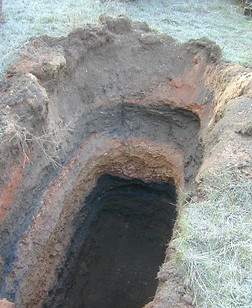
ICE provided geologic and geotechnical engineering services associated with developing land with high density residential housing and roads at Issaquah Highlands, an area underlain by abandoned underground coal mines. As part of ICE’s services, we drilled test borings into the underground mines to evaluate historic mine map accuracy and the character of the overlying bedrock and unconsolidated soil deposits. ICE also provided design geotechnical services for the construction of four large detention ponds (all of which required Washington Department of Ecology Office of Dam Safety review), underground pipelines in steep hillside areas, evaluation of ancient landslide features, fill options for park sites and hydrogeologic evaluation of a large stormwater infiltration system. In addition to design services, between 2002 and 2010, ICE provided geotechnical services during construction of roads, utilities, ponds and other elements of site infrastructure.
This project required geotechnical engineering analysis consistent with WSDOT Standard Specifications and City of Issaquah and King County Road Standards.
Preliminary Coal Mine Hazard Assessments
Location: King County, Washington | Owner: Various Owners
ICE has completed more than 200 preliminary coal mine hazard assessments on properties within King County. These properties area indicated in local and county land use codes as “coal mine hazard areas.” These preliminary coal mine hazard assessments include a detailed review of current topography and historic coal mine maps, surface reconnaissance, interviews with local people knowledgeable of the abandoned mines, mine mapping including the development of geologic cross-sections and analysis of regional ground subsidence (sinkholes, vertical subsidence, ground strain and ground tilt). ICE has developed a computer application for this analysis of regional ground subsidence.
The analysis of coal mine hazards is developed by ICE by participation on a technical team of local professional engineers, geologists, mining engineers and public agency representatives. ICE has been active since the late 1980’s in the development of technical information related to the understanding and assessment methods of coal mine hazards in Washington.
South Service Center Spokane Street Exit Modifications
Location: Seattle, Washington | Owner: Seattle City Light
ICE provided geotechnical engineering services for the South Service Center Spokane Street Exit Modifications project for Seattle City Light. This project included multiple improvements, including installing a 113-foot high tapered-steel transmission pole, repositioning and expanding a service dock, removing and replacing the salvage office building and adding dock capacity for salvage operations, and rebuilding existing asphalt to better support heavy vehicle traffic. The South Service Center is underlain by compressible and liquefiable soils. Our evaluation of the site included drilling three test borings to 60 feet, laboratory testing of soils, deep foundation piles analysis (axial and lateral loads), and pavement section recommendations for light and heavy wheel loads. Our analysis included use of computer applications LIQUEFYPRO, SETCON, PILECAP and LPILE.
ICE provided geotechnical consultation and construction observation services for the transmission pole. ICE also provided environmental services for this project, including 33 soil probes for the purpose of obtaining soil and groundwater samples.
Twin Rivers Quarry Landslide Evaluation, Mitigation and Mine Reclamation
Location: Clallam County, Washington | Owner: Lafarge North America

A large landslide occurred within an inactive clay mine referred to as the Twin Rivers Quarry, about 23 miles west of Port Angeles. The landslide extended to the beachfront of the Strait of Juan de Fuca. As a result of the landslide, the Washington State Department of Natural Resources issued an Agreed Emergency Order requiring that Lafarge monitor for additional ground movement, evaluate immediate repairs as necessary and develop a plan to repair the landslide.
ICE completed a preliminary evaluation of the landslide and setup surface ground control survey monitoring stations and photo stations within and adjacent to the landslide mass; these survey stations were monitored. ICE completed a subsurface exploration and ground movement (instrumentation) monitoring program, including the installation of inclinometers and piezometers; these inclinometers were monitored for movement. ICE completed a detailed evaluation of the landslide cause/mechanism and provided recommendations for mitigation. ICE concurrently developed a final reclamation plan for the Twin Rivers Quarry.
PREVIOUS
MORE
